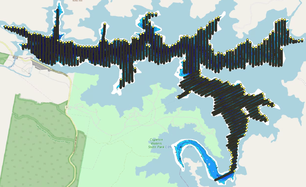
PROCESS IMPROVEMENTS SCALE DATA COLLECTION
Infofish started formal surveys in 2018. At the time there was very limited side-facing survey experience globally, Over 3 years Infofish refined the survey process and data processing capacity to scale up from small samples to entire rivers or impoundments.
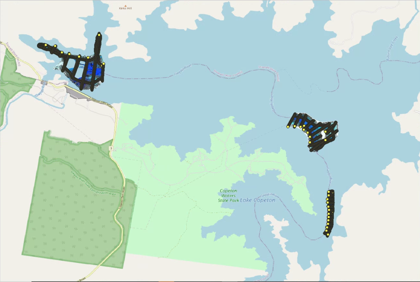
Survey coverage Copeton Dam 2019 vs 2021 Compared
BATHYMETRY
Bathymetry is the foundation of all surveys, without good bathymetric data analysing fish data becomes highly error prone and habitat assessments lack critical context. Infofish has developed a methodology that balances the need for high detail on important features such as river channels, ridges and edge with efficiency on broad basins where larger areas have less important details.
Bathymetry at Lake Eungella, Mackay
HABITAT
Hi-Resolution sidescan has changed the game for fishers, giving them unparalleled views of the uderwater environment. Over the past 3 years Infofish has developed survey techniques that scale the capture of sidescan data to enable researchers and decision makers access to rich habitat datasets when planning projects.
Hi Resolution Mapping of the Upper Brisbane River
CODED HABITAT
Coded Habitat adds additional mapping layers to sidescan habitat maps to view specific habitat elements in scale such as Timber, Weed Beds or Rock Bars. Additional mapping layers provide an enhanced view of the available habitat to different fish species.
Coded Habitat Weed Beds (Green) and Submerged Timber (Red) at Lake St Clair
FISH/BIOMASS
Infofish has been a leader in side facing fish surveys since 2018. Side facing BioSonics Scientific echo sounders detect fish up to 200m away allowing for excellent efficiency in surveys. Fish surveys are conducted in parallel with Bathymetry and Sidescan to provide a single comprehensive dataset that provides everything needed for accurate fish detection and removal of environmental signals such as timber.
Lake Glenbawn Fish Biomass. Yellow=20-50cm, Green=50-70cm Red=>70cm
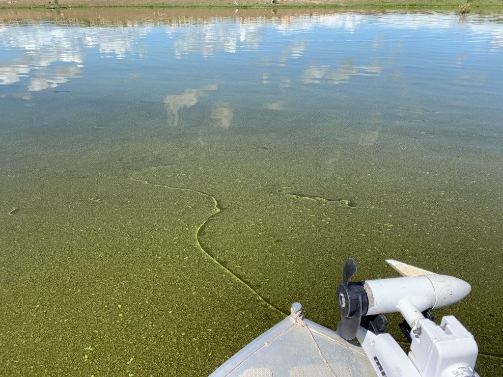
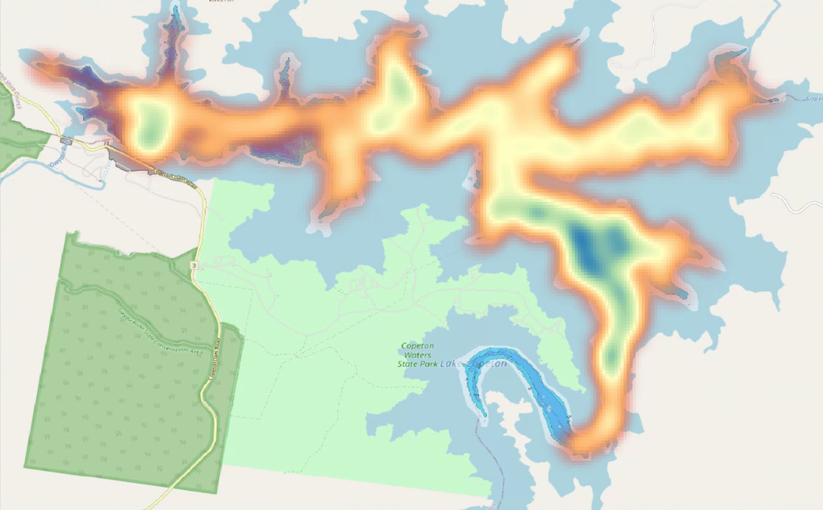
ALGAL BLOOMS
Algal blooms affect fish and people alike, causing behavioural changes in fish and preventing access to good habitat. In 2021 as part of a Biomass Survey, Infofish developed a method to map out the algal bloom for both depth and density. The survey generated nearly 4 Million datapoints a huge step up on manual sample methods.
Algal Bloom mapping at Lake Copeton
RIPARIAN MAPPING
Fish habitat doesn’t stop at the waters edge, the riparian zone is important especially in rivers. In 2021 Infofish added a riparian mapping process that combines high resolution photography and sidescan to provide a complete picture from 40m before the waters edge into the riparian zone.