The common question(s) that typically prompt a survey are:
- How many fish are in the waterbody?
- How big or what range of sizes are the fish are in the waterbody?
- How are fish distributed throughout the waterbody and what habitats are they associating with?
- Are fish mobile or relatively still?
- What part of the water column are fish occupying?
- How many species of fish make up the assemblage or community within a site / waterbody?
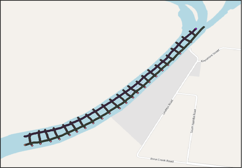
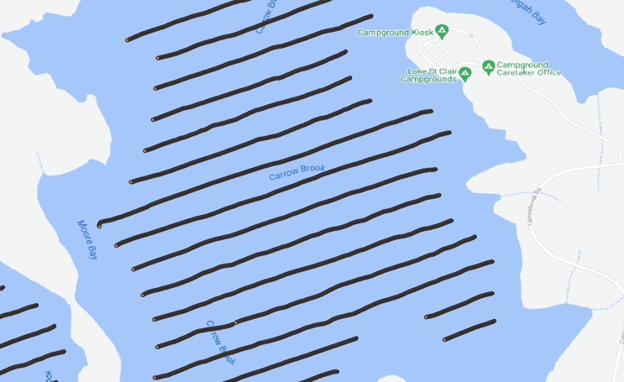
The waterbody is commonly an estuarine / riverine environment or enclosed waters e.g. dam / impoundment and the survey approach can vary slightly between the two. Survey reaches in a riverine environment are typically 1km in length but can be increased as necessary. Surveys in enclosed waters typically cover the whole body of water. See below for examples survey transects for a riverine reach survey and a section of dam / impoundment survey. In larger impoundments or open water surveys, predefined survey transects are generated in ReefMaster and installed into the fish finder to aid in vessel navigation. Once a survey reach (riverine) or zone (impoundment) has been defined, the survey methods for each are as follows:
Riverine
- two longitudinal transects (one upstream and one downstream) with the vessel travelling parallel to the right / starboard bank, and
- where the river is greater than 30m wide, a number of transects across the waterbody spaced 100m apart (water depth dependent), are surveyed.

Enclosed waters / impoundment
- a number of transects across the waterbody, spaced 100m apart. Transect are aligned so that the majority run perpendicular to the dam alignment and / or submerged river channel.

TRANSDUCER CONFIGURATION
For side-looking surveys, all data is collected with the transducer aimed to the port side of the vessel, angled downwards to -2 to -6 degrees below horizontal. The optimum angle is calculated prior to survey, based on pre-survey bathymetry modelling and will vary with depth e.g. shallower angles are used in shallower waters. With the transducer in this configuration, pings are sent and echoes received from up to 200m away. The farther the range surveyed, the greater portion of water column is covered as the ping cone becomes wider. See Table below for estimates of ping cone width and water volumes surveyed in commonly used survey ranges.

| Survey Range (m) | Cone Diameter at End Range (m) | Water Volume Surveyed (m3) |
| 10 | 1.1 | 3.17 |
| 50 | 5.8 | 440 |
| 75 | 8.7 | 1,490 |
| 100 | 11.6 | 3,520 |
| 200 | 23.3 | 28,400 |

